
Speak With An Experienced Drone Expert
Meet the demands of modern agriculture with drones that redefine efficiency. From EVO II 640T for livestock management, the DJI Mavic 3 Multispectral for precision farming, to the the Matrice 350 RTK for expansive farm inspections, there's no task too big or too detailed. Whether you're overseeing vast fields or vast herds, our drone lineup ensures you're always ahead. Explore more and revolutionize your agriculture practices.
Applications for Agriculture
7 Ways Drones Can Benefit Farmers and Agriculture Research Bodies
| Precision Farming | Drones gather precise data about a farm's fields. They use sensors and imaging capabilities to produce detailed maps that show variations in soil and crop health. With this intel, farmers can selectively apply fertilizers and pesticides, maximizing yield and minimizing expenses. |
|---|---|
| Crop Health Monitoring | Before a farmer even spots trouble, drones equipped with multispectral and hyperspectral sensors can pinpoint disease, pests, or stress in plants. Early action means fewer lost crops. |
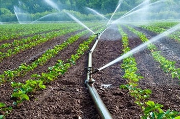
| Irrigation Management | Drones equipped with thermal cameras can identify variations in soil moisture and detect areas of a field that may be over-irrigated or under-irrigated. Farmers using this data can make better decisions on irrigation for efficient water usage and optimizing crop yield. |
| Planting | Some drones don’t just hover – they plant! They fire seed pods packed with nutrients into the ground. Even on terrains or conditions too tough for conventional machinery, drones will get the job done. |
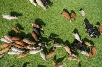
| Livestock Monitoring | For farmers with large pastures or rangelands, monitoring livestock can be time-consuming. With an aerial view of the livestock, farmers get to ensure that their herds are healthy, well-fed, and safe from predators. Say goodbye to those exhaustive, manual field checks. |
| Estimating Crop Yields and Growth | With the high-resolution imagery provided by drones, farmers can estimate crop yields more accurately. They can also monitor growth stages and assess if crops are developing as expected. This allows for better planning of harvest timings and logistics. |
| Research & Development | Helping scientists study plant growth, crop response to different inputs, and the impact of environmental factors on agricultural output. |
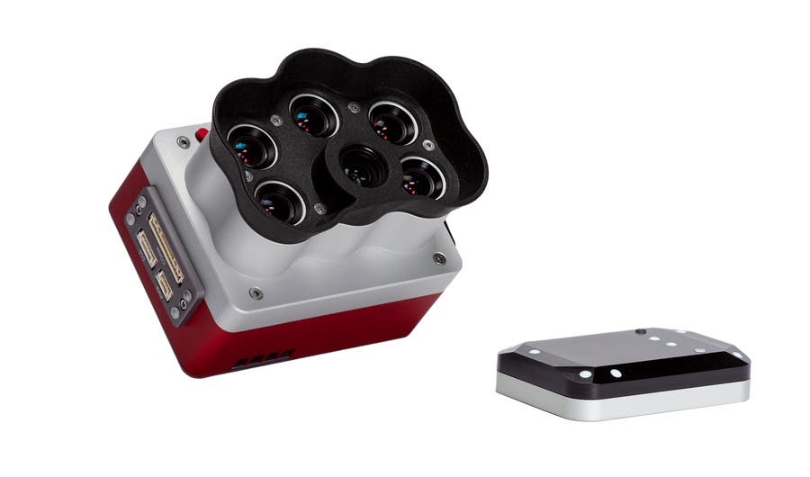
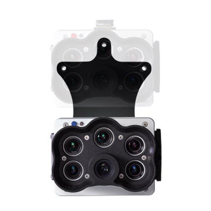
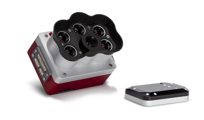
Healthy vegetation reflects more of certain types of light compared to unhealthy vegetation. These discrepancies are undetectable to the naked human eye, but drones carrying multispectral sensors allow them to detect up to five discrete spectral bands of light (near-infrared, red edge, green, blue) that are reflected from plant life. The ability to detect certain types of light being reflected by crops allows farmers to identify nutrient deficiencies and even detect diseases before they become problematic enough to be visible to the naked eye. This detection ability, in addition to the precision GPS available in many drone models and thermal camera sensors, aids farmers in tasks such as phenotyping, crop health mapping, water stress analysis, leak scouting, fertilizer management, zone mapping, and more. Farmers can easily download data gathered by drones for later analysis by various software programs designed to help farmers make informed decisions about their crops.
How Agras Drones Can Reduce Kneading Losses by Tractors | DJI Agras Case Study
How Drones Are Transforming Pasture Farming for Guilherme and Local Producers
DJI Mavic 3 Multispectral to Spark the Development of Precision Agriculture
Saving Up To 95% Water, Improves Efficiency, While Saving Chemicals
Learn About the Technologies for Agriculture Inspection
In the dynamic world of agriculture, technological advancements are consistently reshaping the landscape. It's a combination of advanced aerial technology and smart analytics to monitor crops, assess plant health, and ensure maximum yield.
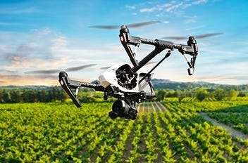
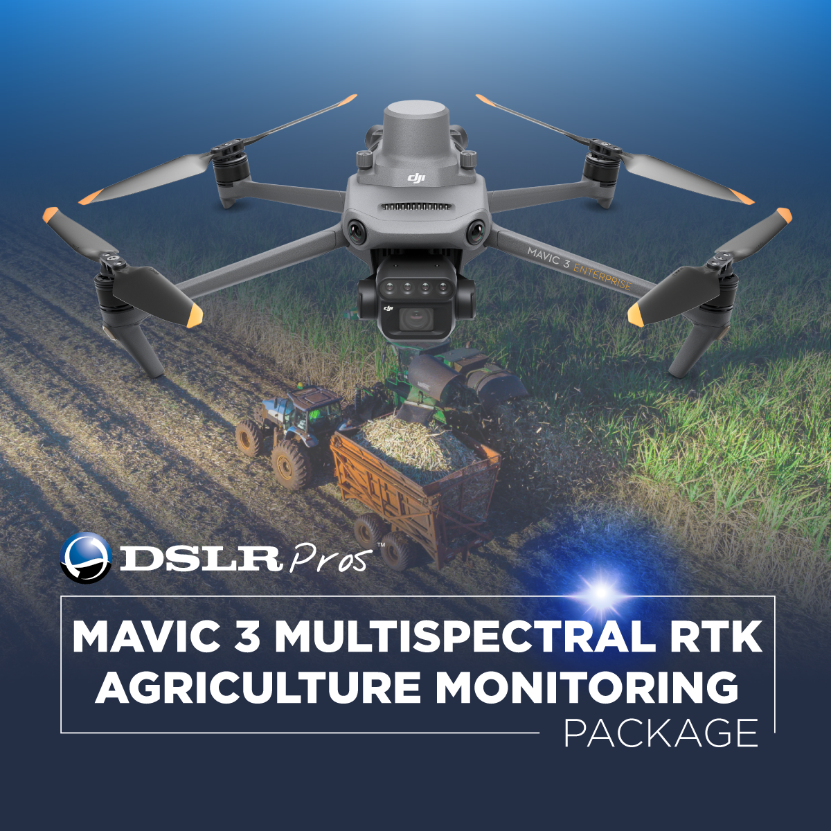
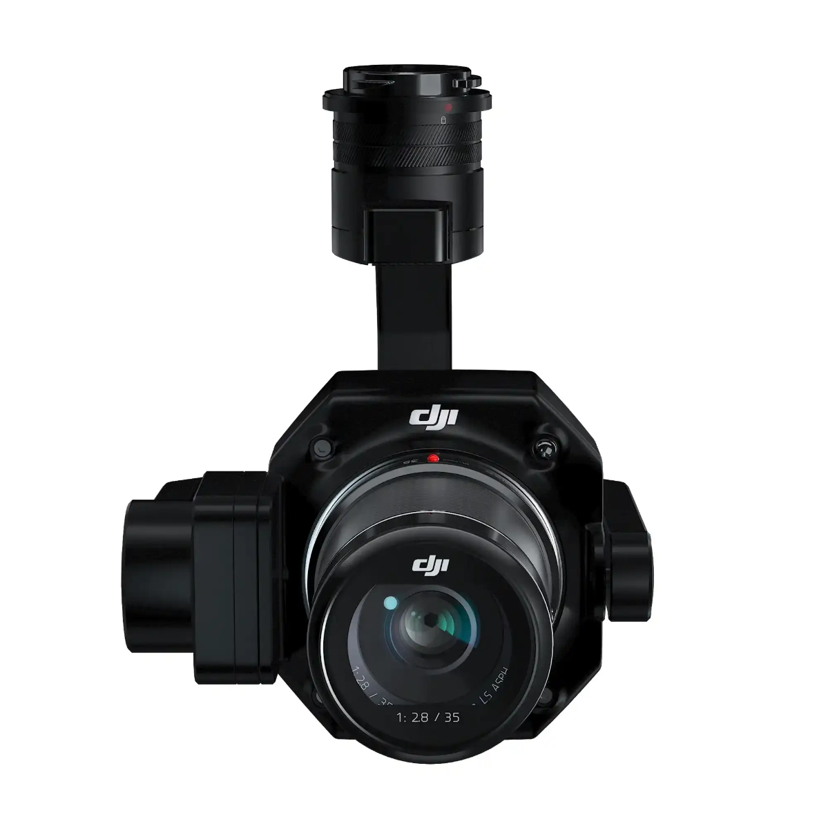
Take the DJI Mavic 3 Multispectral for instance. It is designed for precision and efficiency, this agriculture drone captures a world invisible to the naked eye with its four 5MP multispectral cameras. It's a quintessential tool for tasks like orchard mapping and environmental monitoring. The sunlight sensor adjusts picture data for accurate NDVI results, making it a formidable tool in the world of farm drones.
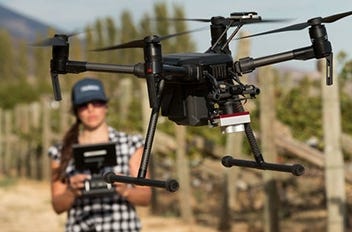
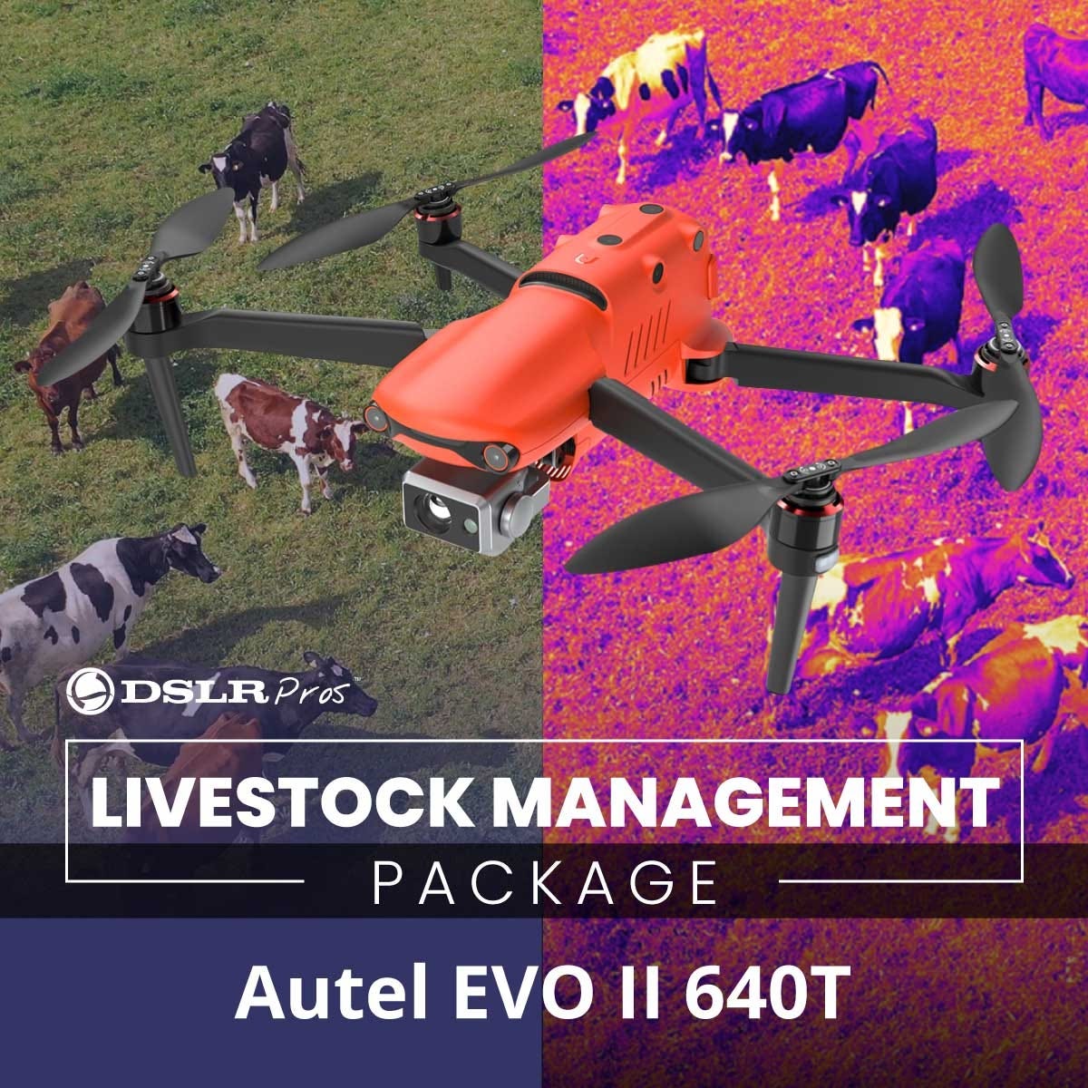
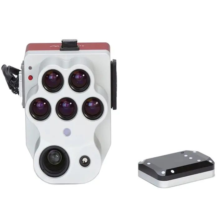
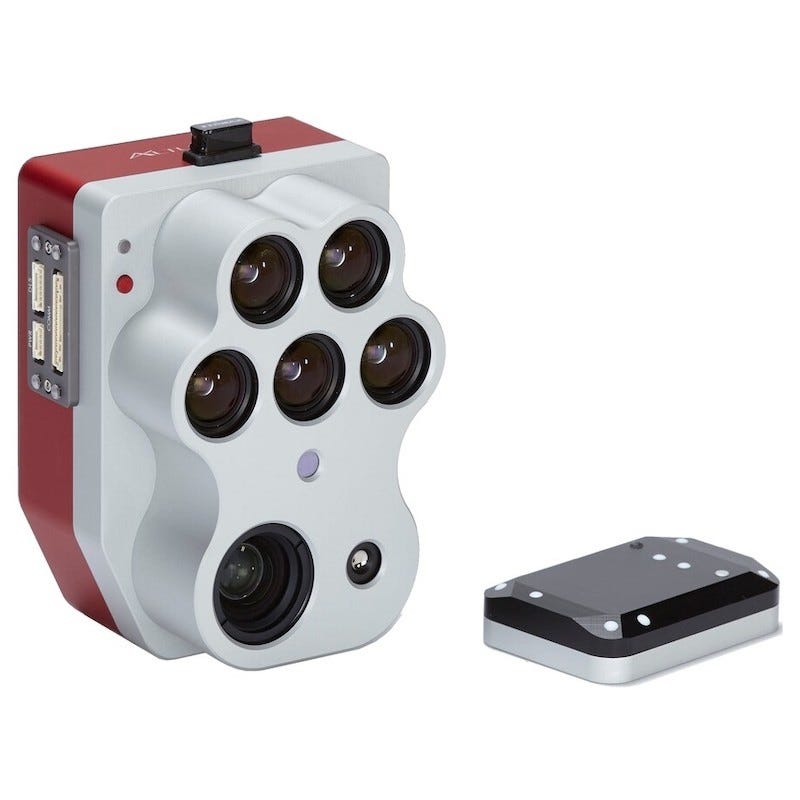
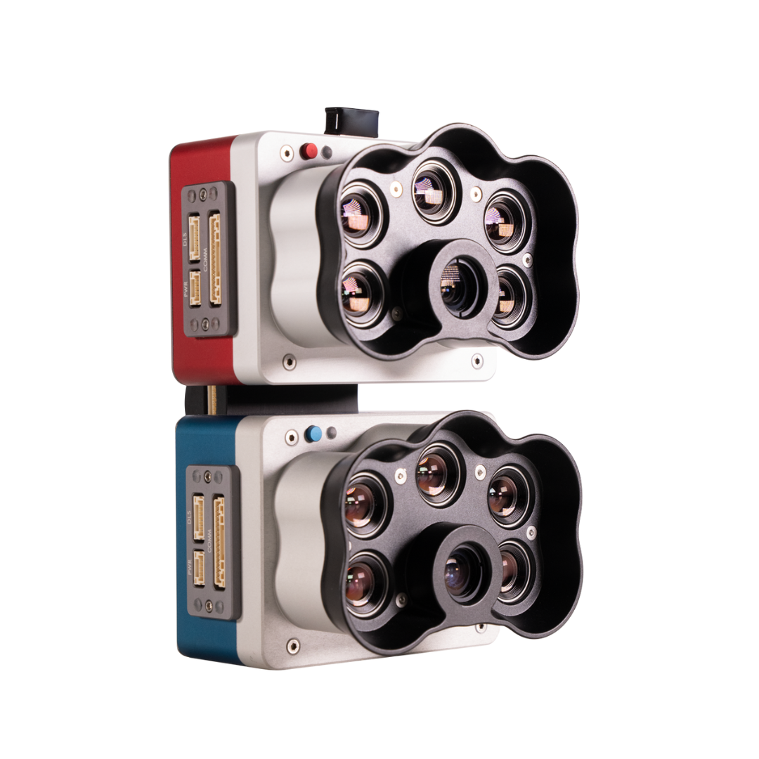
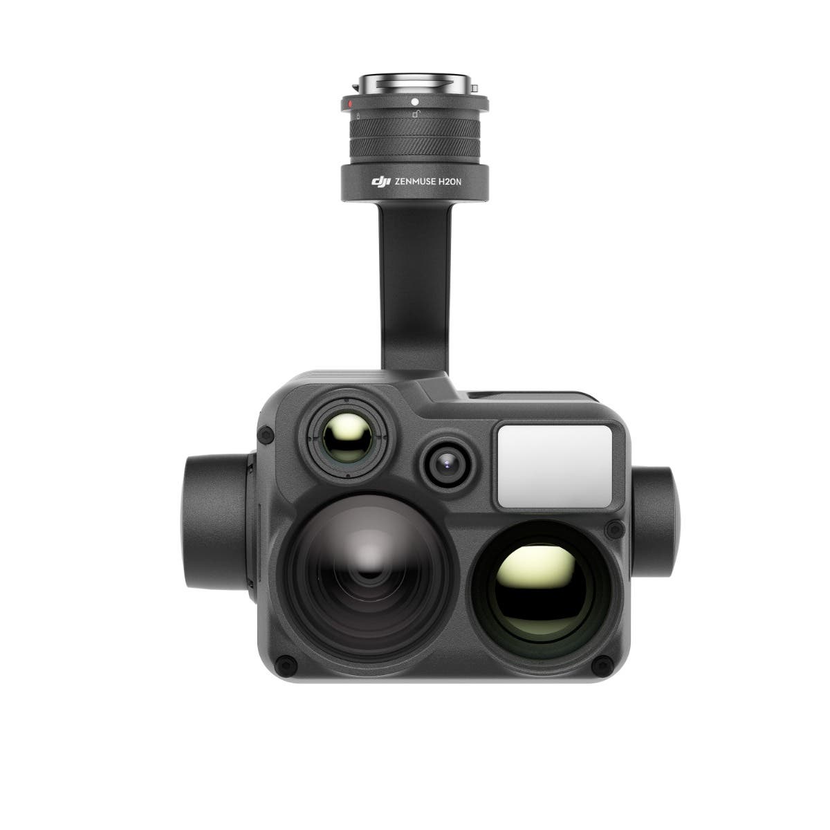
But what if you're managing livestock? The DSLRPros EVO II 640T Livestock Management Package is tailored for you. This all-rounder offers a dual visual and thermal camera setup, letting you observe livestock even at night. Its 8K video with a 4x lossless zoom ensures you can identify cattle from a considerable distance, making it arguably the best drone for cattle farming.
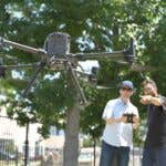
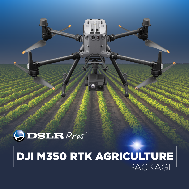
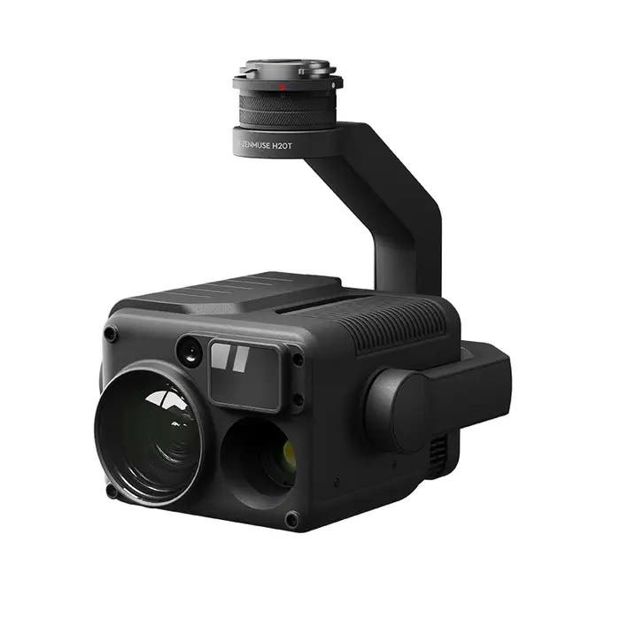
Of course, efficiency in coverage is also paramount. Enter the DSLRPros Matrice 350 RTK Agriculture Package. This drone is perfect for large-scale agricultural inspections. Its compatibility with payloads like MicaSense gives you flexibility in visualizing intricate details of plant health and irrigation levels. With its RTK technology, precision in crop monitoring and field mapping has never been better.
So, what should you consider when scouting the best agricultural drones for sale?
- Coverage Capability: The ability to cover vast terrains is crucial, especially for expansive farms.
- Image Resolution and Quality: Look for drones with high-resolution imaging to get detailed insights.
- Flight Time: Longer flight durations mean more extended inspections in a single trip.
- Versatility: A drone that can be customized, such as the ability to change payloads, offers flexibility for varying farming needs.
If you're in the market for agricultural drones for sale, check out DSLRPros lineup. Whether it's cattle management or crop inspection, there’s a drone package that matches your needs.
DJI Enterprise - Managing Forests Using DJI Matrice 350 RTK
DJI Agriculture: Mavic 3M Fruit Tree Aerial Survey and Mapping
Mavic 3M Review: How M3M Work in Different Operation Scenarios
Discover the Future of Farming Today! Explore our range of Agriculture & Farming Drones and bundles. Need guidance? Just ring us at (877) 299-1075 or (213) 262-9436, or drop a line at sales@DSLRPros.com. We're here to help!
Payloads for Agriculture & Farming Drones


The DSLRPros Advantage

UAV THERMAL EXPERTS
We are industry leaders in thermal imaging drones. As one of the pioneers in thermal drone technology, our team of experts will help you build a custom solution that meets both your budget and needs.

MISSION SPECIFIC SOLUTIONS
We specialize in the development and delivery of cost effective mission specific enterprise solutions. All our kits are specially designed, assembled, and individually tested for quality assurance in the United States.

AFTER PURCHASE SUPPORT
Our customer service doesn't just end with your purchase; we go the extra mile to make sure our customers have the guidance they need. As our customer, you will know us by name and can count on us for support whenever you need it.
The DSLRPROS Advantage
UAV THERMAL EXPERTS
We are industry leaders in thermal imaging drones. As one of the pioneers in thermal drone technology, our team of experts will help you build a custom solution that meets both your budget and needs.

MISSION SPECIFIC SOLUTIONS
We specialize in the development and delivery of cost-effective mission-specific enterprise solutions. All our kits are specially designed, assembled, and individually tested for quality assurance in the United States.

AFTER PURCHASE SUPPORT
Our customer service doesn't just end with your purchase; we go the extra mile to make sure our customers have the guidance they need. As our customer, you will know us by name and can count on us for support whenever you need it.