
Shop Zenmuse P1

Shop Zenmuse P1 Ultra HD Drone Camera

-
 DJI Zenmuse P1 with Care Enterprise Plus
As low as $6,800.00
-
 DJI Zenmuse P1 with Care Enterprise Basic
As low as $6,250.00
Revolutionizing Aerial Surveying with the DJI Zenmuse P1
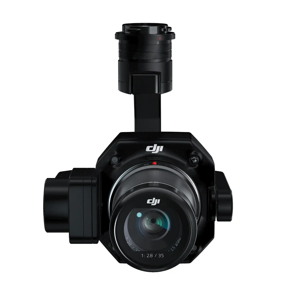
The DJI Zenmuse P1 is a groundbreaking tool in the world of aerial photogrammetry. This advanced camera system sets a new standard for accuracy and efficiency in aerial survey missions. With its full-frame sensor, interchangeable fixed-focus lenses, and a 3-axis stabilized gimbal, the Zenmuse P1 is engineered to elevate photogrammetry flight missions like never before.
Unmatched Efficiency and Accuracy
The Zenmuse P1 is not just any camera; it's your key to unlocking extraordinary efficiency in aerial surveying. Capable of covering 3 km² in a single flight and capturing images every 0.7 seconds, this camera system ensures that vast areas are surveyed quickly and with minimal effort. Moreover, its accuracy is unparalleled, achieving 3 cm horizontally and 5 cm vertically without the need for Ground Control Points (GCPs).
Cutting-Edge Features
- 45 MP Full-Frame Sensor: Captures detailed images with a high sensitivity and low noise, extending operational times.
- Global Mechanical Shutter: With a shutter speed of 1/2000 seconds, it guarantees sharp images even at high speeds.
- TimeSync 2.0: Offers microsecond-level synchronization between the camera, flight controller, RTK module, and gimbal, ensuring highly accurate data capture.
- Smart Oblique Capture: Optimizes oblique photography missions by automatically adjusting the gimbal's angle, capturing only necessary images at the flight area's edges, thereby improving post-processing efficiency by 20% to 50%.
Flexible and Robust Versatility
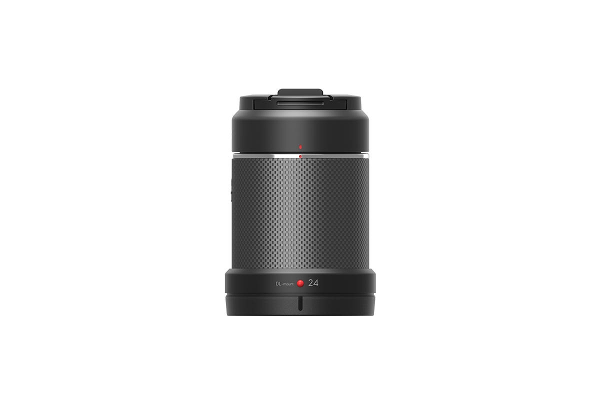
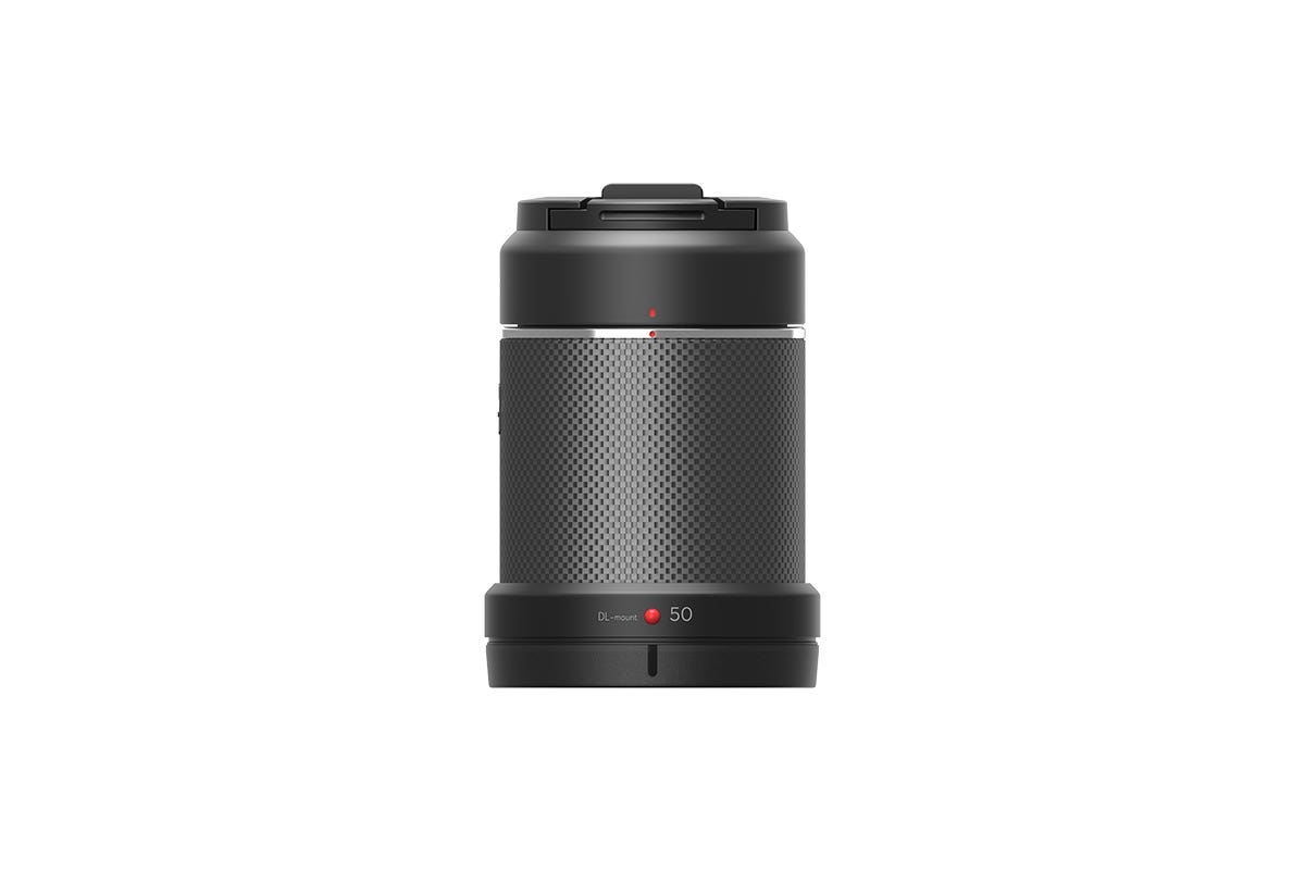
The Zenmuse P1 is designed for versatility, equipped with multiple fixed-focus lens options (24/35/50mm lenses with DJI DL mounts) to meet various surveying needs. Whether you're creating 2D maps, 3D models, or detailed reconstructions, the P1's integrated 3-axis gimbal and Smart Oblique Capture feature ensure you get the job done efficiently and accurately.
Smart Data Management
With the Zenmuse P1, data management becomes effortless. Mission result files are automatically organized by mission name and time, with a centralized storage for photos, GNSS data, and TimeStamps.MRK files. Image metadata includes both intrinsic and extrinsic camera parameters, RTK status, and positioning accuracy, enabling immediate post-flight data quality verification.
A Mission Mode for Every Need
Whether your project requires 2D orthomosaics, 3D oblique models, detailed reconstructions, or real-time mapping, the Zenmuse P1 is up to the task. It's particularly effective in:
- Topographic Mapping: Achieving 1:500 scale accuracy without GCPs.
- Cadastral Surveying: Quickly generating centimeter-level accurate 3D reality models.
- AEC and Surveying: Managing the full project lifecycle with accurate 2D and 3D data.
- Natural Resource Management: Offering precise measurements for environmental conservation.
- Geological Investigation: Providing safe, millimeter-level accurate aerial data of hazardous sites.
- Disaster Site Modeling: Delivering real-time overviews of disaster-struck areas to aid critical decision-making.
The DJI Zenmuse P1 isn't just a camera; it's a comprehensive solution for aerial surveying, combining high efficiency, remarkable accuracy, and versatile functionality to meet the demands of professionals across various industries. Explore the possibilities with the Zenmuse P1 and set new standards in your aerial surveying projects. https://www.dslrpros.com/contact-us!