Speak With An Experienced Drone Expert
Explore the latest in roof inspection technology with DSLRPros!Our drones like the Matrice 350 RTK, Mavic 3 Thermal, and EVO II 640T bring you imaging, thermal capabilities, and ease of use. Check out our full range and choose the right solution for your needs.

Roof Inspection Drones and Bundles
8 Ways Drones Benefit Roof Inspection
| Safety First! | Using drones for roof inspections eliminates the need to physically climb onto a roof, reducing the risk of falls and accidents. Get all the detailed imagery you need using a powerful camera payload without breaking a sweat – or a leg! |
| Cost-Effective | Let's face it, time is money! With drones, you can save big on labor costs associated with manual roof inspections. Not only are drones faster – covering large areas in a fraction of the time, but they can also complete the inspection with fewer resources. |
| Accessibility | Drones can easily access hard-to-reach or dangerous areas of a roof that may be challenging or unsafe for human inspectors - from the chimney areas, channels running down the fold of the roof, eaves and overhangs, to the dormers, gutters and downspout as well as unique architectural features like crow's nests that you can simply pilot the drone to from the safety of the ground. |
| High-Quality Imaging | Drones equipped with high-resolution cameras can capture detailed images and videos, providing a more thorough assessment of the roof's condition. Reveal cracks, chips, or other damage on roofing tiles or shingles that might be hard to see with the naked eye. Identify signs of leaks or water damage, such as dark stains, mold growth, or warped materials. Get close-up images showing areas of the roof that have experienced wear and tear, including faded or worn shingles, and areas where the granules have been worn away. Get high-quality images of seams, flashing, and other transitional areas on the roof where leaks commonly occur to identify any potential vulnerabilities - drones can do it all. |
| Thermal Imaging | Some drones come equipped with thermal imaging cameras that can reveal areas where heat is escaping from a building, indicating poor insulation or gaps in the roofing material. They can also detect temperature differences that may signify water damage – for example, a cooler spot on a roof could be a sign of a leak that's causing the underlying material to retain moisture. This technology can even identify issues such as trapped moisture under roofing materials, or hidden damage caused by storms or hail, which might not be immediately visible. |
| Digital Documentation | Drones can provide digital records of inspections where you can spot subtle changes, like a slow spread of moss or a gradually widening crack, and take action before it becomes a major problem. Plus, these digital records make it easy to share the findings with other stakeholders, from spouses to business partners, and insurance companies. If you're selling your property, you can even show prospective buyers the detailed roof inspection history to instill confidence. It's a visual storyline of your roof's life, right at your fingertips, making it easier to monitor, maintain, and communicate about your roof's condition. |
| Preventative Maintenance | Drones can identify early signs of damage, allowing for preventative maintenance before small issues turn into larger, more costly problems. Spot tiny cracks that could turn into leaks, or a small collection of debris that could cause water pooling and damage, and nip potential problems in the bud. Get the data you need to patch up minor damage or reinforce weak spots, all of which could save you from more extensive repairs (or even a full roof replacement) down the line. |
| Improved Accuracy | Drones have an impressive level of precision and accuracy when it comes to assessing a roof's condition. Calculate the exact dimensions including the areas around features like chimneys, dormers, and skylights. Generate precise 3D models, allowing for a comprehensive analysis of the roof's structure and surface. Identify minor issues such as hairline cracks or slight warping in roofing materials that might be missed by a manual inspection. |
10 Applications of Drones in Roof Inspection
| Leak Detection | With drone roof inspection, you can easily spot potential leaks. Drones can capture high-resolution images of the roof surface and use thermal imaging to detect temperature differences that may indicate water intrusion. |
| Storm Damage Assessment | After severe weather events like hailstorms or hurricanes, drones can swiftly assess roof damage, such as missing shingles, dents, or cracks. It's like having a first responder ready to check on your roof after the storm has passed. |
| Insurance Claims | For insurance companies, drone roof inspections make operations much more efficient. The drones can be used to quickly evaluate roof damage claims, speeding up the claims process and providing more accurate assessments. |
| Roofing Material Assessment | Need to check the condition of your roofing materials? Drones can do the job for you! Whether it's shingles, tiles, or metal roofing, drones can spot signs of wear, aging, or damage. |
| Solar Panel Inspections | For those with solar panels on their roofs, specialized inspection drones can view the condition and positioning of the panels, ensuring they are functioning optimally and not causing damage to the roof. |
| Gutter and Downspout Inspection | Tired of climbing ladders to check your gutters and downspouts? Drones can take that burden off your shoulders! They can effortlessly check your gutters and downspouts for clogs, debris, and damage. |
| Commercial Roof Inspections | For large commercial buildings, drones can conduct efficient and comprehensive inspections of expansive and flat roofing systems, identifying issues like ponding water or membrane damage. |
| Historic Building Inspections | Concerned about maintaining the integrity of a historic building's roof? Drones are here to help! They can inspect the roofs of historic buildings without causing damage or disturbing the delicate structure, ensuring that these important landmarks are preserved for generations to come. |
| New Construction Inspections | Building a new home or commercial space? You'll want to make sure the roof is up to par, right? Construction survey drones can inspect newly constructed roofs, making sure they meet quality standards and pinpointing any potential issues before they turn into expensive headaches. |
| Roof Certification | For real estate transactions, drones can provide detailed roof inspections to certify the roof's condition, giving potential buyers confidence in the property. It's like having a home inspector who specializes in roofs. |
Thermal Roof Inspections, Minnesota
Roof Inspections with Thermal Drones
Roof Inspection With a Drone
Learn About the Technology of Roof Inspection
At DSLRPros, we offer a range of drone packages and payloads tailored for roof inspection. The combination of high-resolution cameras, thermal imaging, and mapping software provides detailed insights into roof condition and potential issues.
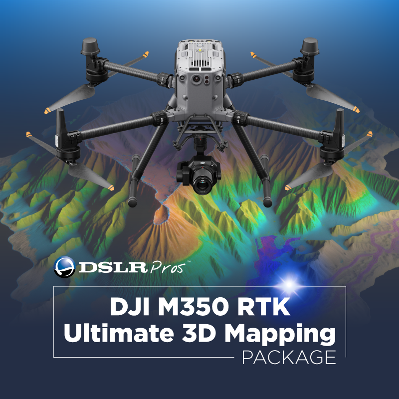
One of our top recommendations is the DSLRPros Matrice 350 RTK Ultimate 3D Mapping Package. This comprehensive package includes the powerful Matrice 350 RTK drone with a built-in RTK for centimeter-level accuracy and the Zenmuse P1 Full-Frame Camera. It captures data with exceptional precision, ensuring accurate roof assessments. With the included DJI Terra Mapping Software, you can seamlessly plan, visualize, and analyze inspection data. The drone is ideal for large-scale roof inspection projects where precision and efficiency are critical. And remember, when you purchase the DSLRPros Matrice 350 RTK Ultimate 3D Mapping Package, you'll receive a limited-time offer of 1 day of FREE in-person training at your location.
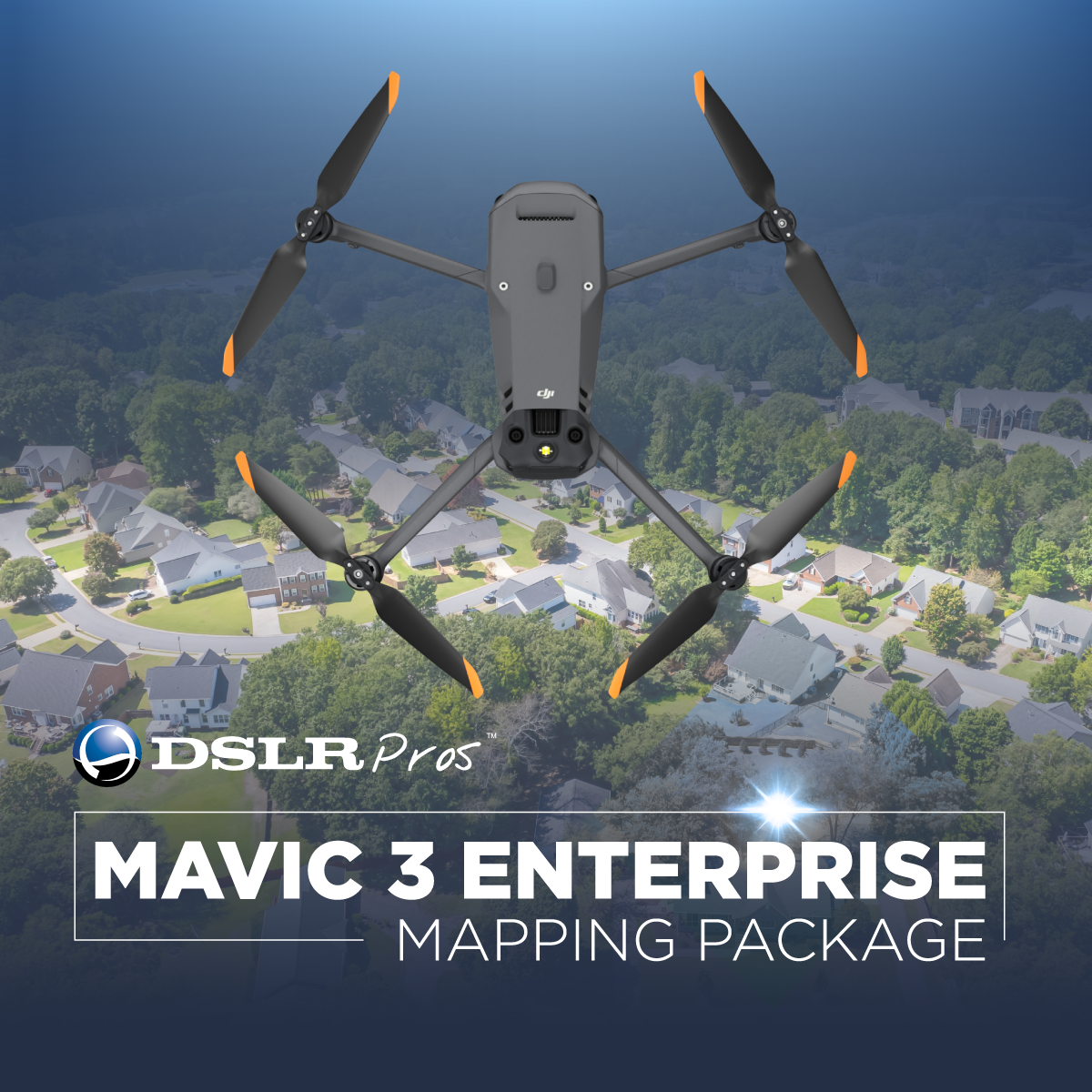
Meanwhile, if you're seeking a lightweight and compact option without compromising on quality, the DJI Mavic 3 Thermal is a prime choice. Weighing only 920 g, it boasts a 45-minute maximum flight time and a robust 640 × 512 px thermal camera. This drone roofing inspection tool is designed for efficiency, especially in identifying temperature disparities that can point to underlying damage. The DJI O3 Enterprise image transmission and omnidirectional obstacle avoidance make it a reliable and safe choice for roof inspections.
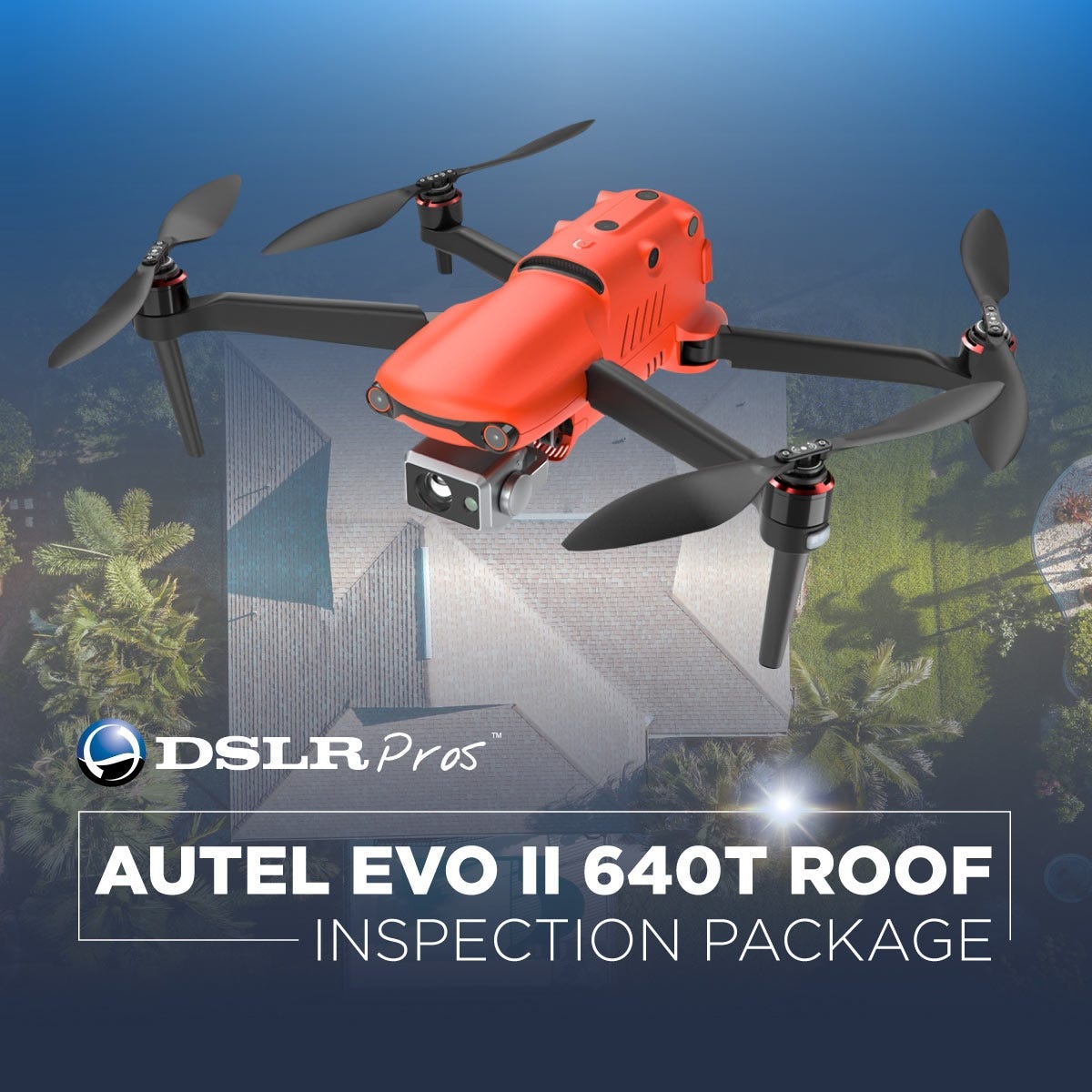
Now, if you're particularly focused on thermal capabilities for your drone roof inspections, check out the DSLRPros EVO II 640T Roof Inspection Package. This drone offers 640 X 512 Radiometric Thermal Images and a visual system with an 8K sensor. The amalgamation of these features makes it great at finding even those subtle roof issues. This package also comes with Autel's brand-new Smart Controller, so you'll have the best control and awareness of what's happening. The EVO II 640T is easy to carry around since it weighs less than 3 pounds and can be folded up into a small size, making it an asset for professionals who need to go to multiple job sites.
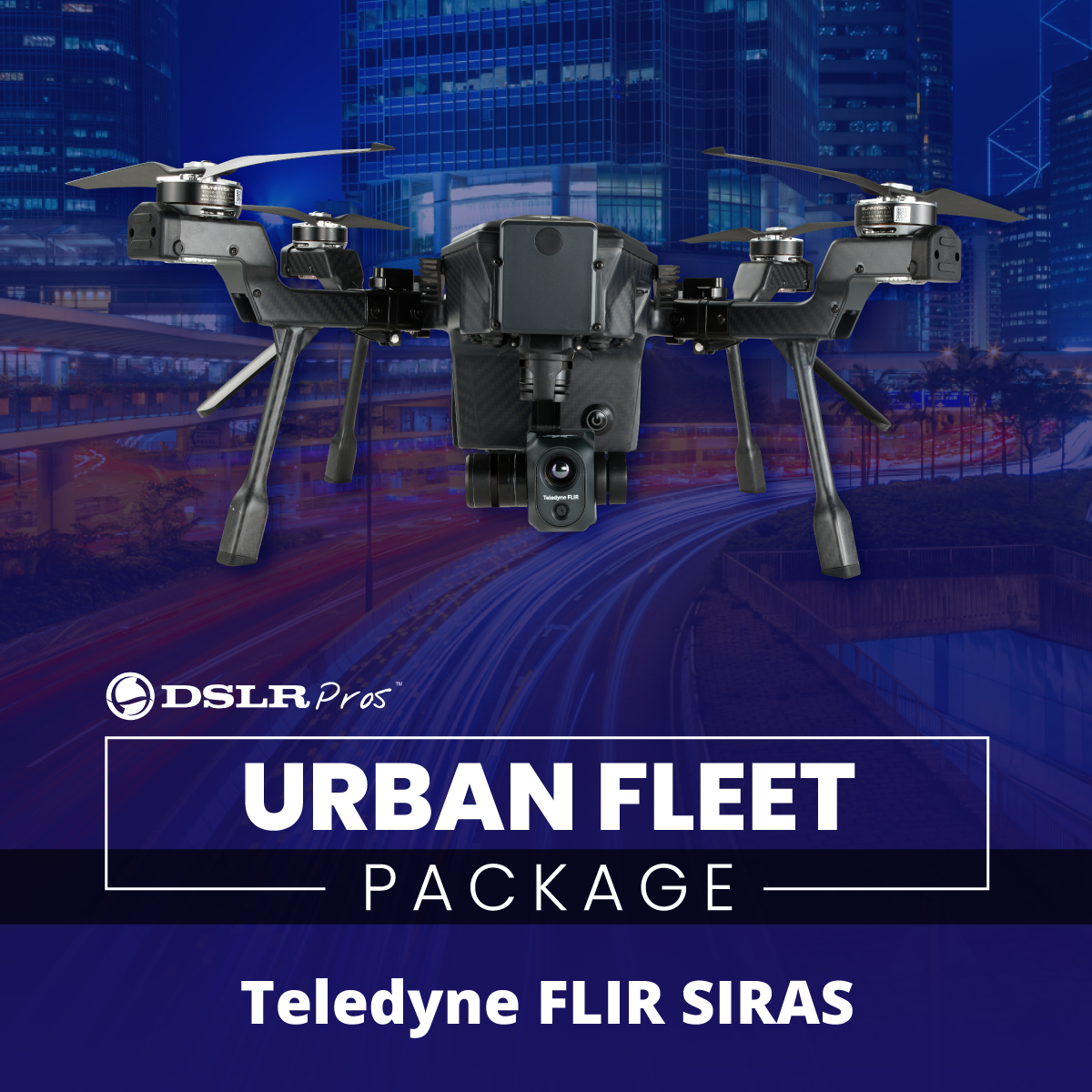
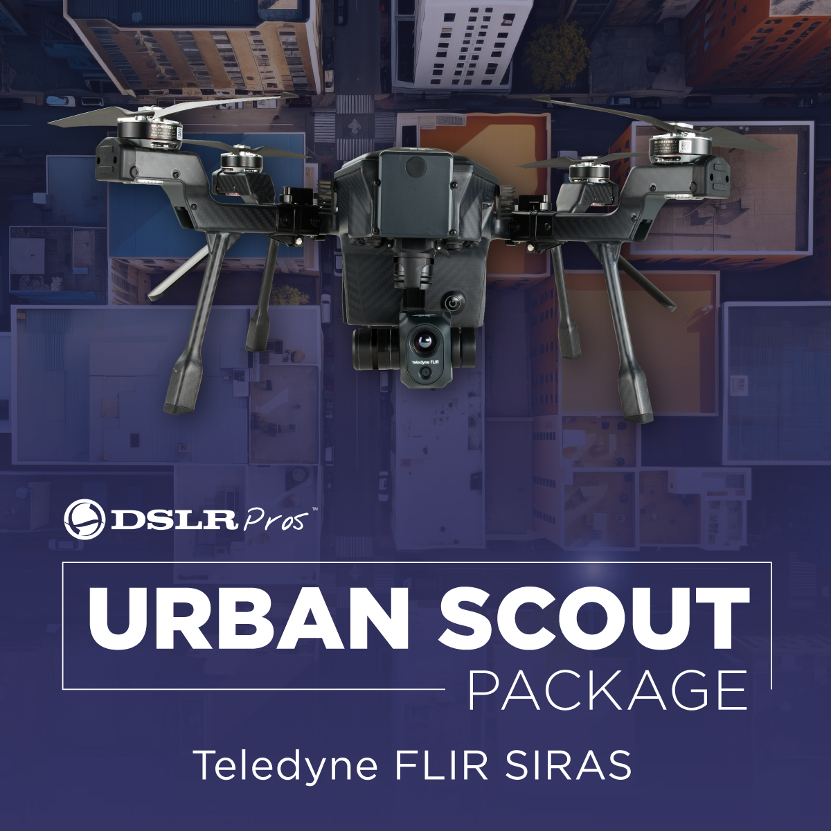
For those who value speed and adaptability, the Teledyne FLIR SIRAS stands out. This drone has no geofencing restrictions and features dual thermal and visible cameras, a Vue TV128 radiometric thermal camera, 16MP visible camera, and 128x zoom. The quick-connect swappable gimbal system makes it future-proof and adaptable to changing inspection needs. With a 31-minute maximum flight time and hot-swappable batteries, the SIRAS Combo is suitable for lengthy inspections without interruptions.
When considering a drone for roofing inspection, always consider:
- Resolution and Image QualityHigher resolution cameras can pick up finer details, crucial for identifying potential issues. Thermal imaging capabilities and the range of analysis that you can undertake with the drone.
- Flight TimeLonger flight times mean more area covered in a single trip.
- Safety FeaturesCollision avoidance, geofencing, and secure data transmission are all essential for ensuring the safety of your operations.
Take your roof inspection to new heights with our range of drones and bundles. Browse our collection today and see what fits your needs. Need help? We're here to assist you - give us a call at (877) 299-1075 or (213) 262-9436, or email sales@DSLRPros.com.
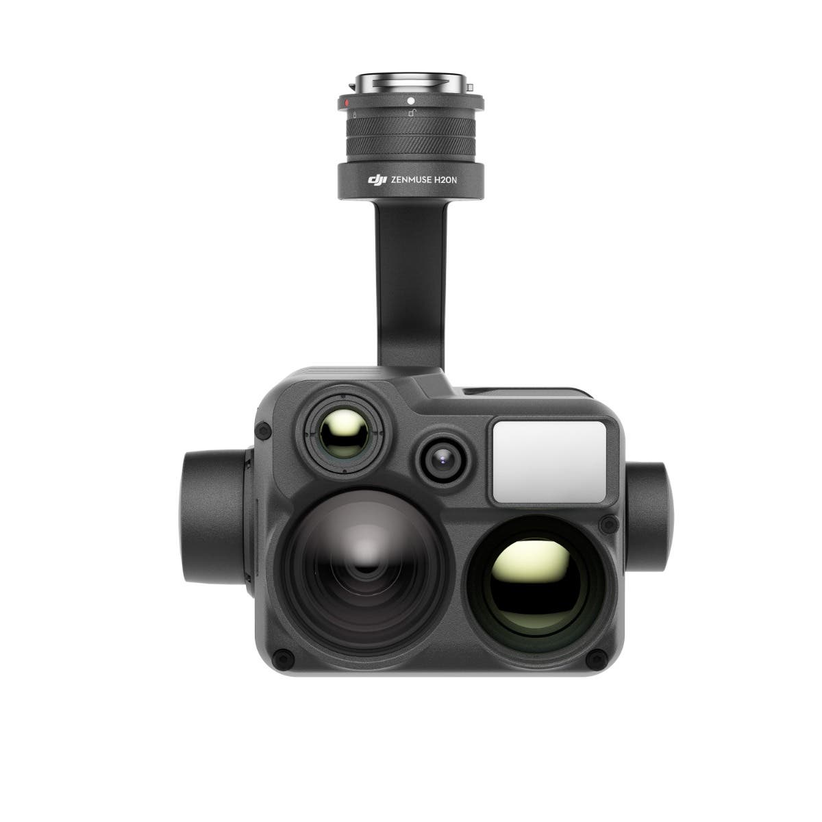
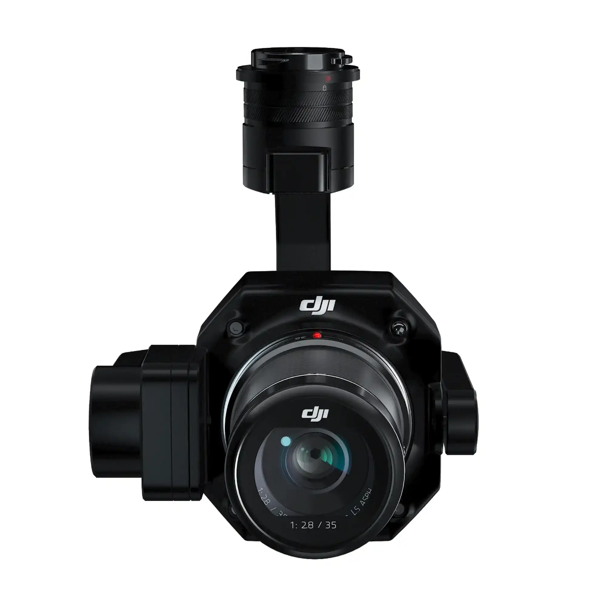
Payloads for Roof Inspection Drones


The DSLRPros Advantage

UAV THERMAL EXPERTS
We are industry leaders in thermal imaging drones. As one of the pioneers in thermal drone technology, our team of experts will help you build a custom solution that meets both your budget and needs.

MISSION SPECIFIC SOLUTIONS
We specialize in the development and delivery of cost effective mission specific enterprise solutions. All our kits are specially designed, assembled, and individually tested for quality assurance in the United States.

AFTER PURCHASE SUPPORT
Our customer service doesn't just end with your purchase; we go the extra mile to make sure our customers have the guidance they need. As our customer, you will know us by name and can count on us for support whenever you need it.
The DSLRPROS Advantage
UAV THERMAL EXPERTS
We are industry leaders in thermal imaging drones. As one of the pioneers in thermal drone technology, our team of experts will help you build a custom solution that meets both your budget and needs.
MISSION SPECIFIC SOLUTIONS
We specialize in the development and delivery of cost-effective mission-specific enterprise solutions. All our kits are specially designed, assembled, and individually tested for quality assurance in the United States.

AFTER PURCHASE SUPPORT
Our customer service doesn't just end with your purchase; we go the extra mile to make sure our customers have the guidance they need. As our customer, you will know us by name and can count on us for support whenever you need it.